This item has been sold, but you can get on the Waitlist to be notified if another example becomes available, or purchase a digital scan.

1950 PORAM Map of Mallorca / Majorca, Spain

Mallorca-poram-1950
$87.50
Mallorca / Mapa de la Isla de Mallorca. - Main View
Processing...

1950 PORAM Map of Mallorca / Majorca, Spain

Mallorca-poram-1950

Attractive mid-century tourist map of the Balearic Island of Mallorca or Majorca.

Title


Mallorca / Mapa de la Isla de Mallorca.
  1950 (dated)     15.5 x 21.25 in (39.37 x 53.975 cm)     1 : 200000

Description


An attractive 1950 tourist map of the Balearic island of Mallorca / Majorca, Spain. The map covers the beautiful island in full, illustrating all roadways, railroad lines, towns and villages, historical sites, mileage, and more. On the recto (back), various advertisements promote tourism related businesses.
Publication History and Census
This map was issued over many years in many editions by the Palma based firm, Ediciones Poram.

Cartographer


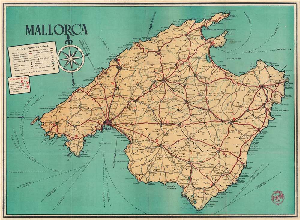
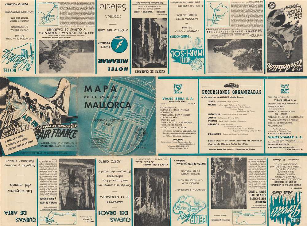
PORAM (fl. c. 1940 - 1962) or Ediciones PORAM, was a Spanish printer based in Palma, Mallorca (Majorca) in the middle of the 20th century. PORAM specialized in tourist maps and brochures, producing maps of Mallorca and Palma, among others. More by this mapmaker...

Condition


Very good. Light wear and soiling along original fold lines. Light creasing.

References


OCLC 15189972.